A weather system expected to strengthen into Tropical Storm Imelda later today before reaching South Carolina’s coastline as a hurricane early next week.
On Sunday it was wreaking havoc in the Bahamas and surrounding islands.
At the same time, Hurricane Humberto weakened slightly but continued as a powerful Category 4 storm in the Atlantic, posing a threat to Bermuda. The news comes as UK weather maps show 603-mile Atlantic storm blast crashing into Britain.
South Carolina Gov. Henry McMaster urged residents to monitor weather conditions carefully and remain vigilant.
In North Carolina, Gov. Josh Stein declared a state of emergency ahead of the system, currently designated as Tropical Depression Nine, reports the Mirror US.
Weather experts said the system was projected to develop into a tropical storm later Sunday and intensify into a hurricane by late Monday or Tuesday.
It would receive the name Imelda.
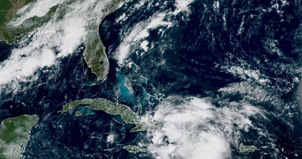
As of 5am ET on Sunday, the system was positioned approximately 100 miles (160 kilometres) west-southwest of the Central Bahamas and was moving north-northwest at 7 mph (11 kph).
Its maximum sustained winds reached 35 mph (55 kph).
“What we learn every time is we never know where they are going to go,” McMaster said during a news conference to discuss the storm.
“This storm is deadly serious. Not just serious. Deadly serious.”
The storm could bring powerful winds and torrential rainfall, potentially triggering flooding, he explained.
The state was deploying search and rescue teams over the weekend. Humberto, a Category 4 hurricane, is maintaining maximum sustained winds of 155 mph (250 kph), according to Miami’s National Hurricane Center.
The storm is situated about 585 miles (945 km) south of Bermuda and is moving west-northwest at 13 mph.
Forecasters have warned that a tropical storm watch may be necessary in Bermuda later today, and swells could reach the U.S. east coast by Monday.
Tropical Depression Nine is posing a threat to parts of Cuba and the Bahamas with heavy rainfall and flash flooding, with some areas of the latter under a tropical storm warning.
More warnings and watches are expected later on Sunday, according to the hurricane center.
The Bahamas’ Department of Meteorology has advised people in the northwest and central islands, including Nassau, Andros Island, San Salvador, and Long Island, to “make final preparations” for tropical storm conditions.
The agency anticipates the system’s center to move across that region throughout Sunday.
“Residents in low-lying areas should take actions to mitigate property damages due to flooding,” the statement read.
The tropical disturbance caused heavy rains in the Dominican Republic on Friday, prompting authorities to evacuate hundreds of people and declare a red alert in five provinces.
Tropical Storm Narda, previously classified as a hurricane, is approximately 1,045 miles west-southwest of the southern tip of Mexico’s Baja California Peninsula and is moving north at 5 mph.
The storm is packing maximum sustained winds of 60 mph.
Forecasters have warned that swells generated by Narda are affecting coastal Mexico and Baja California Sur, with potentially life-threatening surf and rip current conditions in Southern California.