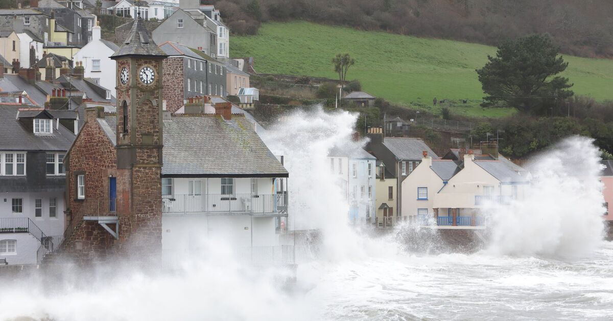
Brits have been warned to prepare for weather-related disruption as warnings are issued for heavy rain and winds in the coming days. The Met Office has issued a yellow weather warning for heavy rain across a stretch of southwest England from Hampshire to Cornwall and up to north Wales from 6pm on Monday until 6pm on Tuesday. People living in 36 parts of the country have been warned they will face increased risks of home and business flooding, communities being cut off and power cuts.
The Met Office said “fast flowing or deep floodwater” is possible in the affected areas, bringing with it a “danger to life”, alongside travel delays via train and bus cancellations, difficult driving conditions and road closures. The national forecaster has also put out a warning for high winds across the same stretch of the country from 10pm on Monday until 4pm on Tuesday.
Steven Keates, deputy chief meterologist at the Met Office, said: “A deepening area of low pressure will approach the UK from the southwest later on Monday, bringing with it heavy rain and strong winds, which are likely to affect the UK between late Monday and early Wednesday.”
Separate weather warnings for rain are in place for northwest England from midnight until 3pm on Tuesday, with a wind warning also issued for northwest Scotland from 3pm on Tuesday until 10am on Wednesday.
It follows a wet and windy weekend across the UK, with a yellow rain warning in place for Northern Ireland and 12 flood warnings in force across England on Sunday.
Most areas were told to expect 15-20mm of rain as a band moved northeast across the country, with some locations, particularly County Down and higher ground seeing 25 – 30mm within six hours.
The Met Office warned: “After a showery start on Monday, an area of low pressure approaching from the North Atlantic will bring heavy rain and strong winds from late Monday into Tuesday. Yellow warnings for rain and wind are in place for parts of Wales, southern and southwest England, northern England, and western Scotland.”
the forecaster’s Deputy Chief Meteorologist Dan Holley said: “Whilst there is some uncertainty as to the exact track and intensity of the area of low pressure as it passes close to western Scotland later on Tuesday, many parts of the UK are likely to see spells of rain which, given saturated ground, could lead to flooding and delays to road and rail travel.
“In addition, strong winds are expected, particularly in northern and western areas. We are closely monitoring developments and may issue updates to the warnings as the situation evolves.”
England
– Hampshire
– Bath and North East Somerset
– Bournemouth Christchurch and Poole
– Bristol
– Cornwall
– Devon
– Dorset
– Gloucestershire
– Isles of Scilly
– North Somerset
– Plymouth
– Somerset
– South Gloucestershire
– Torbay
– Wiltshire
– Herefordshire
Wales
– Blaenau Gwent
– Bridgend
– Caerphilly
– Cardiff
– Carmarthenshire
– Ceredigion
– Conwy
– Denbighshire
– Gwynedd
– Merthyr Tydfil
– Monmouthshire
– Neath Port Talbot
– Newport
– Pembrokeshire
– Powys
– Rhondda Cynon Taf
– Swansea
– Torfaen
– Vale of Glamorgan
– Wrexham.