Scorching temperatures are set to hit the UK on three days in June, with 30C heat predicted across the country. Summer is already in full swing, with a blast of warm weather seeing Brits bask in the sun.
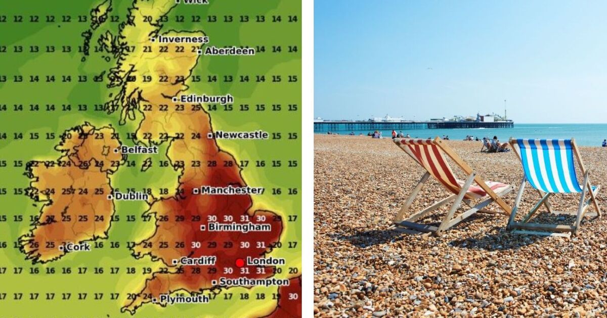
But latest maps from WXCHARTS show scorching temperatures will hit a peak for three days – from June 21 to June 23. Maps show the hottest conditions will be seen in London and the south east of England, with some areas to see highs of 35C. On June 21 at 6pm, around 28C to 30C will be seen in most parts of the country including the Midlands, the east of England and the south of England. These temperatures will be seen in Birmingham, Nottingham, Norwich, Oxford, Dover and surrounding areas. The north will not miss out, with the high temperatures also expected around York.
Some areas will see slightly cooler temperatures, towards the north of England there will be 23C, which is the lowest any part of England will see. This will be seen in Cumbria with areas such as Carlisle and Penrith.
On Sunday, June 22, warm weather will again be seen with a similar pattern. The coolest area will again be the Lake District in Cumbria with 22C.
As for Scotland, temperatures will range from 17C to 25C in areas such as Edinburgh, Glasgow, Dundee and Fife. Again, the east of England and London will see around 29C to 30C with Norwich, Ipswich, Colchester and Cambridge due to see the heat.
On Monday, June 23, at 6pm, maps show 35C could be seen in Colchester, with dark red indicating hottest areas.
A Met Office forecast says: “Most parts of the UK are expected to be fine and dry at the start of this period, with a low risk of thundery showers in the west.
“Then a northwest to southeast split is likely to develop. The wettest and windiest conditions are expected in the northwest, with rain at times which may be heavy in places.
“It will likely be very warm or perhaps hot at first in the north, quickly becoming near normal or slightly above.
“More settled in the southeast with conditions drier overall, although some rain will probably spread from the west or northwest at times.
“There is also the risk that isolated heavy showers and thunderstorms could develop at times. Temperatures are expected to be above normal, perhaps with some hot spells.”