The Met Office has issued new amber weather warnings for parts of the UK, with millions of people braced for the impact of Storm Floris. The Met Office amber warning says Storm Floris will bring a spell of unusually strong west or northwesterly winds to much of Scotland between 10am and 11pm on Monday (August 4).
It adds: “Gusts of 50 to 70 mph are expected for many parts, and are likely to reach 80 to 90 mph on some exposed coasts, hills and bridges. Western coastal areas will see the highest gusts between late morning and early afternoon, the strongest winds then transferring to northeastern Scotland by late afternoon/early evening.”
Central, Tayside & Fife
Angus
Clackmannanshire
Dundee
Falkirk Fife
Perth and Kinross
Stirling
Grampian
Aberdeen
Aberdeenshire
Moray
Highlands & Eilean Siar
Na h-Eileanan Siar
Highland
Orkney & Shetland
Orkney Islands
SW Scotland, Lothian Borders
East Lothian
Edinburgh
Midlothian Council
Scottish Borders
West Lothian
Strathclyde
Argyll and Bute
East Ayrshire
East Dunbartonshire
East Renfrewshire
Glasgow
Inverclyde
North Ayrshire
North Lanarkshire
Renfrewshire
South Lanarkshire
West Dunbartonshire
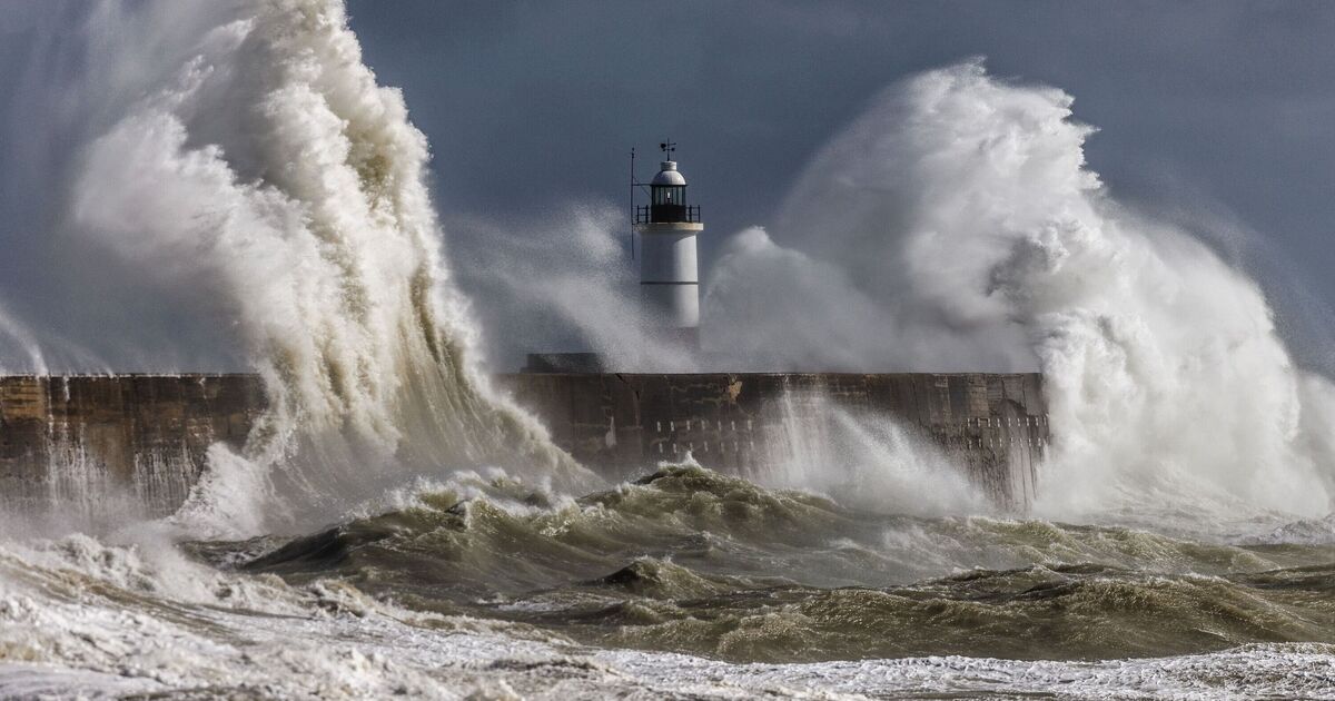
The Met Office has said people in areas covered by its amber warnings can expect injuries and danger to life from large waves and beach material being thrown onto sea fronts, coastal roads and properties.
Some damage to trees and buildings is expected, including tiles blown from roofs. Travellers can expect longer journey times and cancellations as road, rail, air and ferry services will be affected. Some roads and bridges will be closed as well, according to the forecaster’s warnings.
Flying debris could lead to injuries or danger to life while power cuts with the potential to affect other services, such as mobile phone coverage, are expected.
The Met Office recommends checking outside your home for any loose items and taking steps to secure them.
This includes bins, plant pots and garden furniture. Trampolines should be turned upside down or secured with tent pegs and the doors of garden sheds should be locked.
The forecaster also suggests planning your route if you need to travel. It advises checking for travel updates on your car radio or sat nav and packing essentials such as warm clothing, food, drink, a blanket and torch.
A fully charged mobile phone with an in-car charger or battery pack is another item the Met Office recommends travelling with.
For drivers, the forecaster advises driving slowly, being aware of high-sided vehicles, exercising caution when overtaking such vehicles, holding the steering wheel firmly and giving cyclists, motorcyclists, lorries and buses more room than usual.
Those who live or work at the coast should check forecasts and tides, beware of large waves, take care if walking near cliffs and in an emergency call 999 and ask for the Coastguard.
The Met Office notes: “Being outside in high winds makes you more vulnerable to injury.
“Stay indoors as much as possible. If you do go out, try not to walk or shelter close to buildings and trees.”
It urges people to be prepared for weather warnings to change quickly too.