
Snowfall across the UK according to WXCharts (Image: WXCharts)
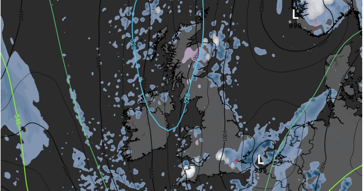
UK weather maps from WX Charts show chilly weather hitting the UK next week, with some regions expecting snow.
The maps that use MetDesk data forecast temperatures below freezing in the cold snap.
The data predicts that some parts of the UK will experience the white stuff from the early hours of Thursday, May 14 to the afternoon of Friday, May 15.
The heaviest snowfall appears to be forecast for Scotland, with some southern counties also likely to see some of the white stuff on Friday.
Across the two days, 16 regions will see sprinklings of snow.
The early morning hours will see most of the flurries.
In Scotland, temperatures will drop to -2C, across the rest of the UK, they will remain between 0C and 6C.
In England, West Yorkshire is expected to see snow on Thursday.

The majority of the snowfall on Thursday will be in Scotland (Image: WXCharts)
Read more: UK weather maps show -3C freeze hitting in days as temperatures plunge in May
Read more: Weather maps show snow as far south as England on Wednesday – 9hrs of blizzards
On Friday, later in the day, more areas across the south, including Devon and Dorset can expect to see some snowfall.
Wales is also expecting some chances of snow on the Friday. The forecast shows that areas of Powys may be hit on high ground in the early hours of next Friday.
Regions that can expect snow
- Edinburgh
- Highland
- Tayside
- West Yorkshire
- Clwyd
- Northumberland
- Argyll & Bute
- Grampian
- Teeside
- Powys
- Devon
- Dorset
- Cornwall
- Sussex
- Berkshire
- Oxfordshire
The long range weather forecast from the Met Office said, for the period from Monday, May 11 to Wednesday, May 20, that conditions would be “changeable and at times rather unsettled conditions look to dominate through the middle part of May, with low pressure often close by.
“This means periods of rain or showers, some of which could be heavy, for many places, though some drier interludes are also expected.
“For the most part, temperatures are likely to be close to or perhaps a little below normal, though depending on the position of low pressure relative to the UK, there is the chance of brief warmer, more humid interludes extending north from the near continent.
“With this would be the chance of some thunderstorms, these most likely affecting parts of England and Wales.”

More snow is expected in England on the Friday (Image: WXCharts)
The long range weather forecast from the Met Office said, for the period from Monday, May 11 to Wednesday, May 20, that conditions would be “changeable and at times rather unsettled conditions look to dominate through the middle part of May, with low pressure often close by.
“This means periods of rain or showers, some of which could be heavy, for many places, though some drier interludes are also expected.
“For the most part, temperatures are likely to be close to or perhaps a little below normal, though depending on the position of low pressure relative to the UK, there is the chance of brief warmer, more humid interludes extending north from the near continent.
“With this would be the chance of some thunderstorms, these most likely affecting parts of England and Wales.”